 View larger
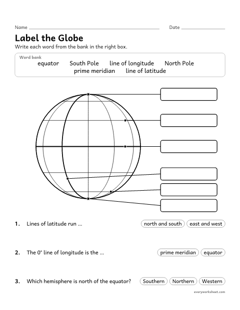
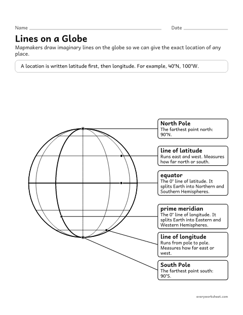
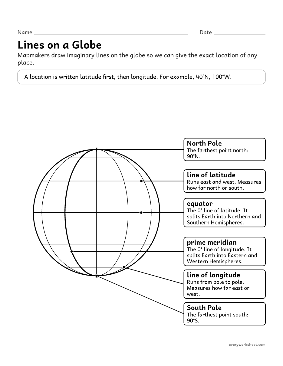
Latitude and longitude globe diagram (Labeled)
Naming the equator, prime meridian, poles and lines of latitude and longitude
1 page34 KB
Lines on a globe, reading and plotting coordinates on a grid, hemispheres, and the coordinates of world cities.
View largerNaming the equator, prime meridian, poles and lines of latitude and longitude
1 page34 KB
 View all 2 pages
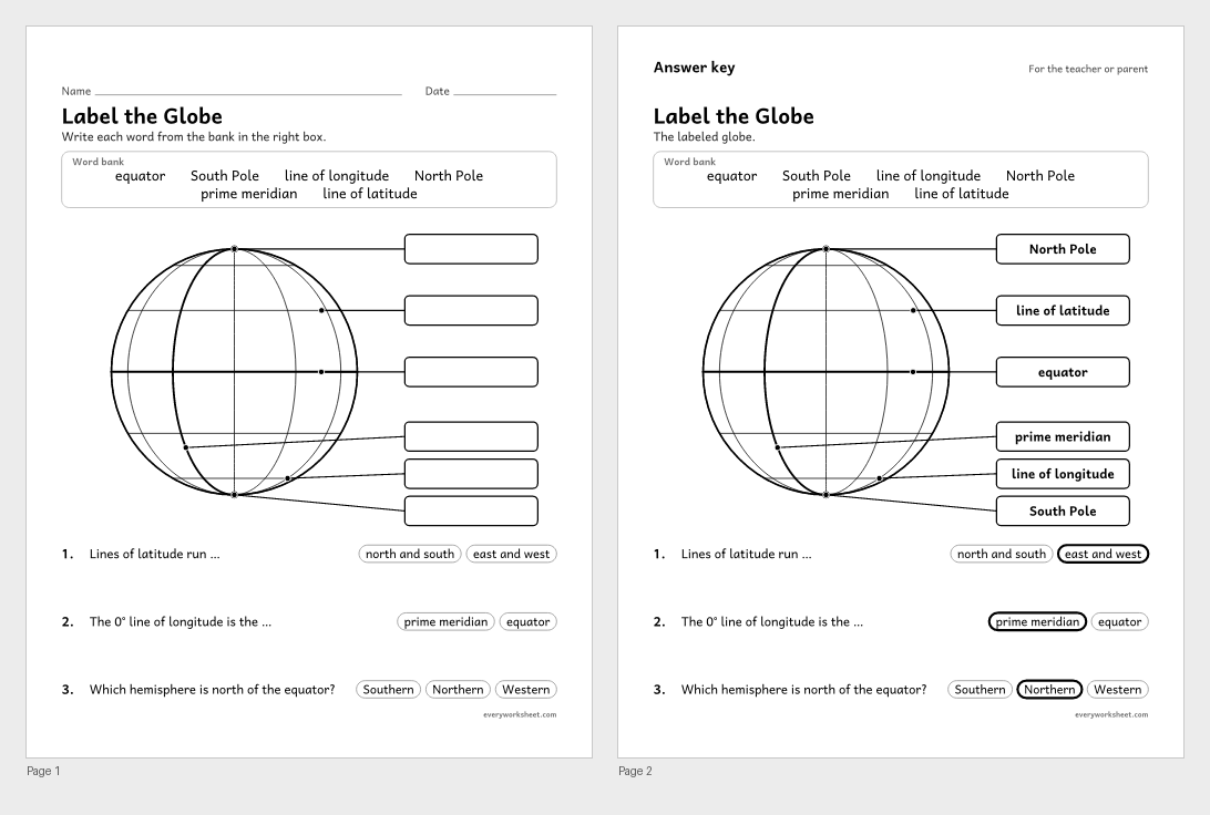
Labeling the equator, prime meridian, poles and lines of latitude and longitude
Answer key on page 2
2 pages43 KB
 View all 2 pages
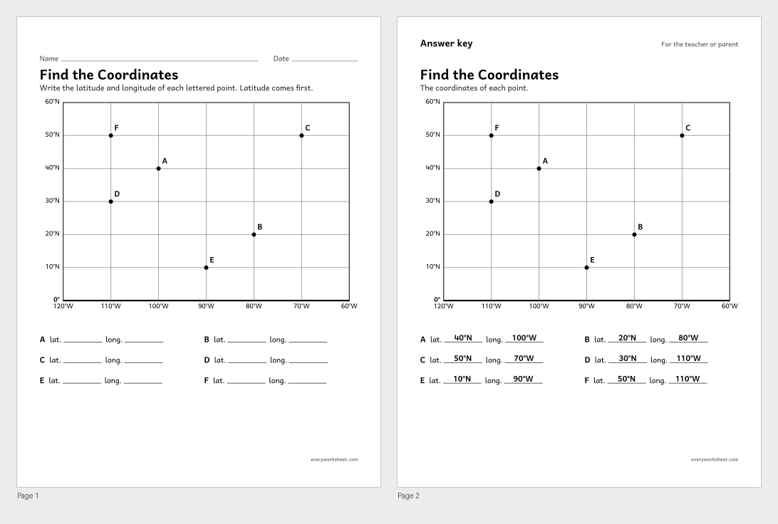
Reading the latitude and longitude of points on a grid
Answer key on page 2
2 pages39 KB
 View all 2 pages
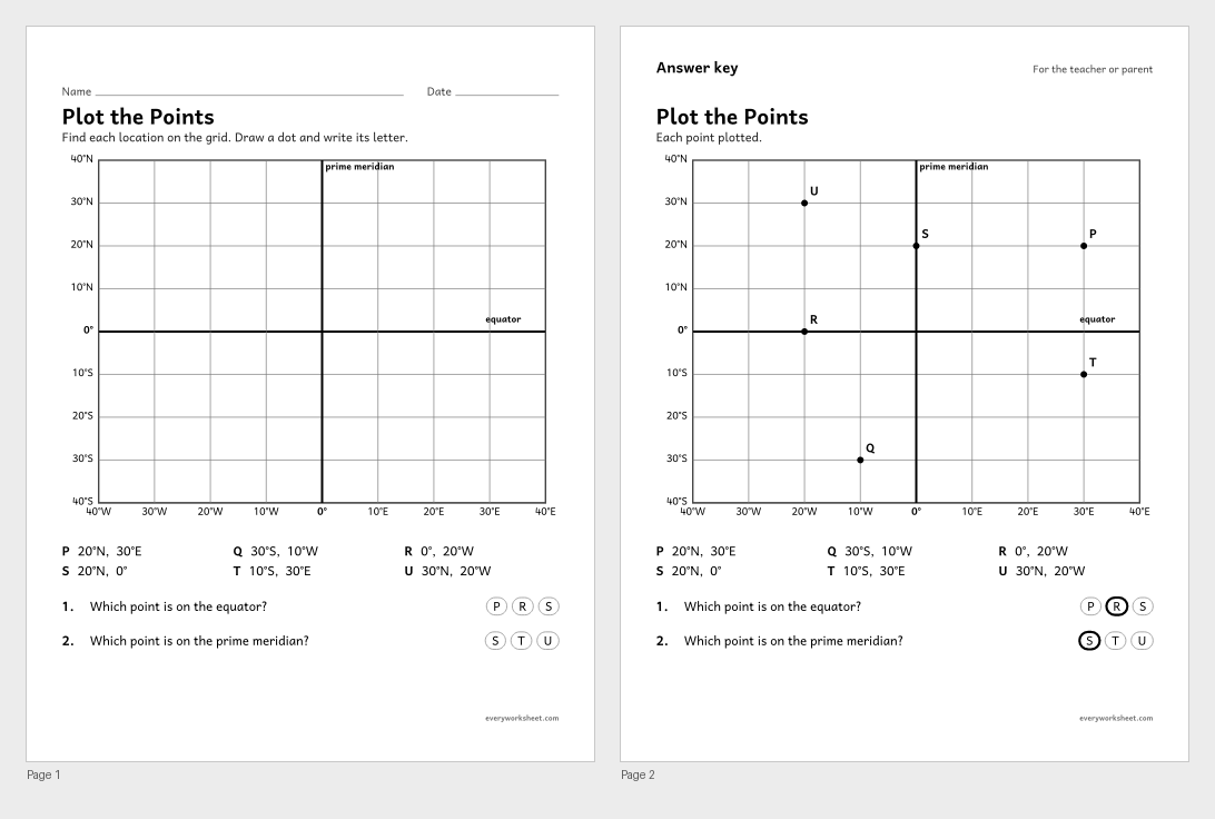
Plotting points on a grid from their latitude and longitude
Answer key on page 2
2 pages37 KB
 View all 2 pages
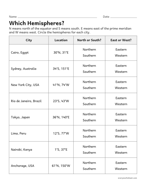
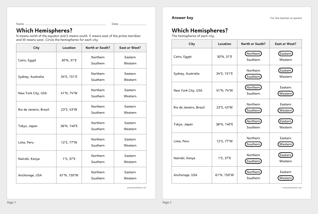
Using latitude and longitude to name a place's hemispheres
Answer key on page 2
2 pages45 KB
 View all 2 pages
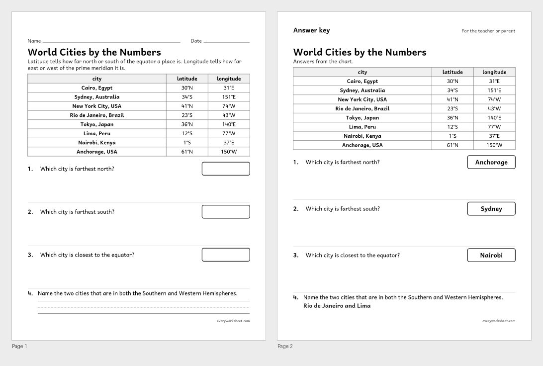
Comparing places by their latitude and longitude
Answer key on page 2
2 pages48 KB
 View all 2 pages
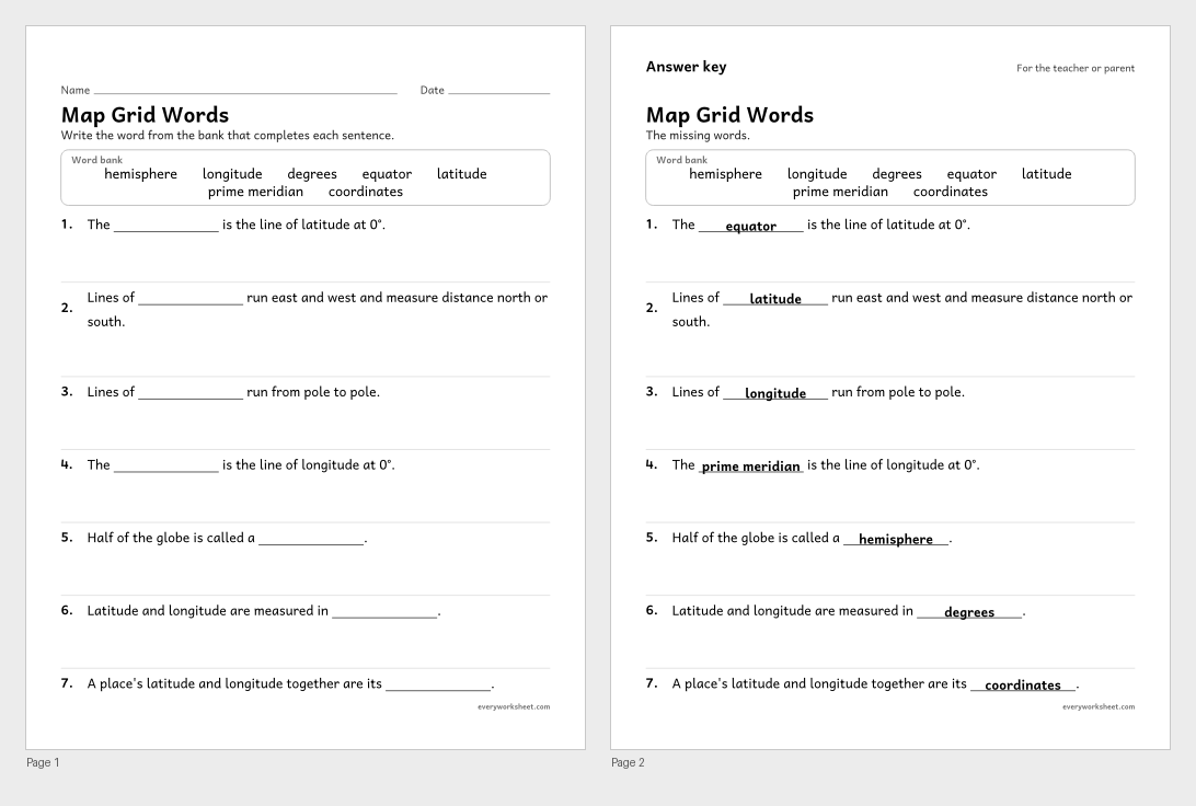
Using latitude and longitude vocabulary in context
Answer key on page 2
2 pages38 KB
 View all 2 pages
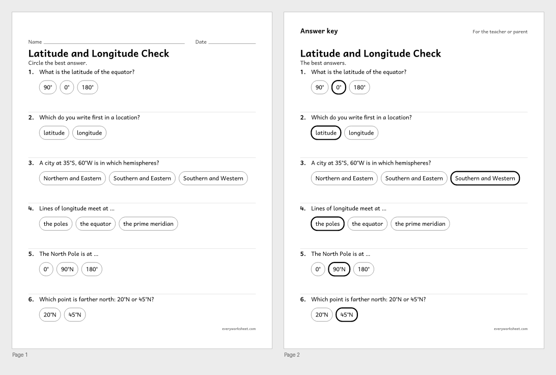
Reviewing latitude, longitude and hemispheres
Answer key on page 2
2 pages40 KB
Print at 100% (actual size) for the cleanest tracing lines.
Latitude and longitude are imaginary lines that let us give the exact location of any place on Earth. Lines of latitude run east and west and measure how far north or south of the equator a place is. Lines of longitude run from pole to pole and measure how far east or west of the prime meridian it is.
These latitude and longitude worksheets start with a labeled globe and a globe to label, then practice on simple grids: read the coordinates of lettered points and plot points from their coordinates. Children name the hemispheres of world cities and compare cities by their coordinates.
Every page is black and white, prints on US Letter or A4, and every page with right answers has an answer key on page 2.
C3 D2.Geo.1.3-5Construct maps and other graphic representations of both familiar and unfamiliar places.CCSS.ELA-LITERACY.RI.4.4Determine the meaning of general academic and domain-specific words or phrases in a text relevant to a grade 4 topic or subject area.Latitude lines run east and west and tell how far north or south of the equator a place is. Longitude lines run north and south between the poles and tell how far east or west of the prime meridian a place is.
Latitude comes first, then longitude. For example, New York City is at about 41°N, 74°W.
The equator is the 0° line of latitude, halfway between the poles. The prime meridian is the 0° line of longitude, running through Greenwich, England.