 View all 2 pages
Regions of the united states chart for 4th grade
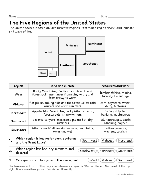
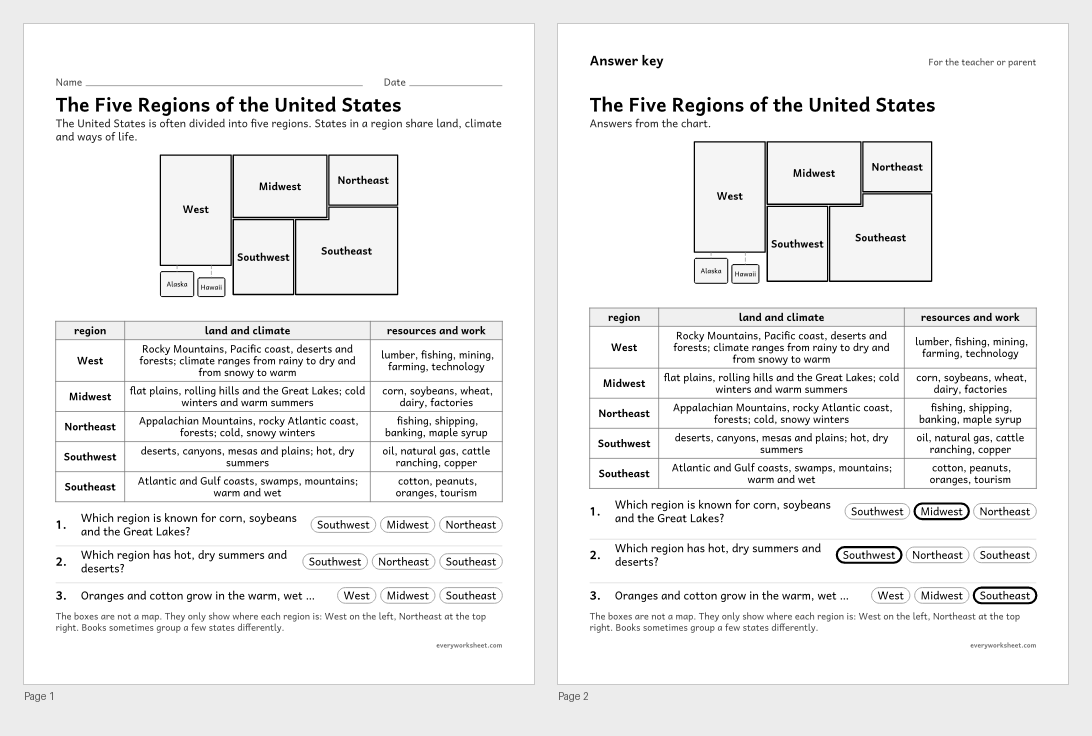
Describing the land, climate and resources of the five U.S. regions
Answer key on page 2
2 pages48 KB
The five U.S. regions, their land, climate and resources, the states in each, riddles, a comparison and a research organizer.
View all 2 pagesDescribing the land, climate and resources of the five U.S. regions
Answer key on page 2
2 pages48 KB
 View all 2 pages
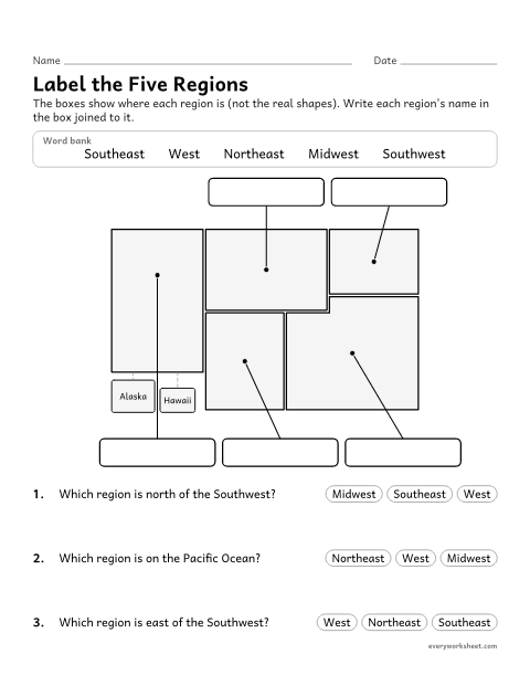
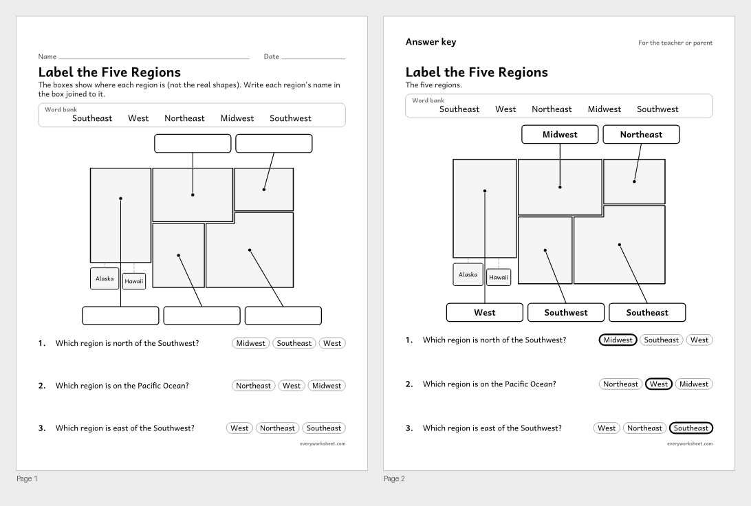
Labeling the five regions of the United States on a diagram
Answer key on page 2
2 pages37 KB
 View all 2 pages
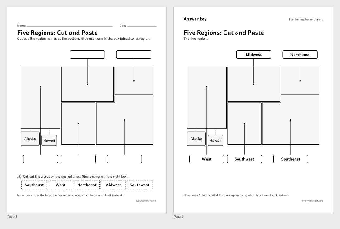
Labeling the five regions of the United States on a diagram
Answer key on page 2
2 pages59 KB
 View all 2 pages
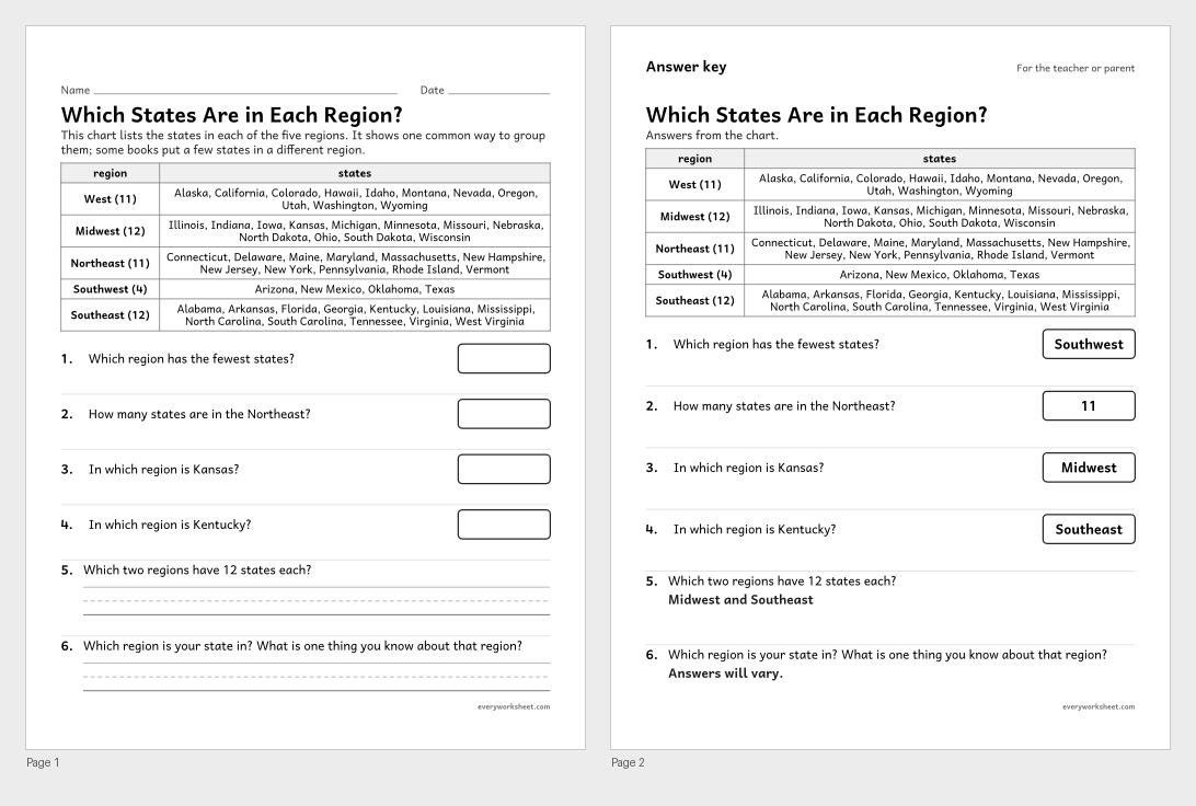
Reading a chart of the states in each U.S. region
Answer key on page 2
2 pages47 KB
 View all 2 pages
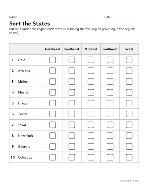
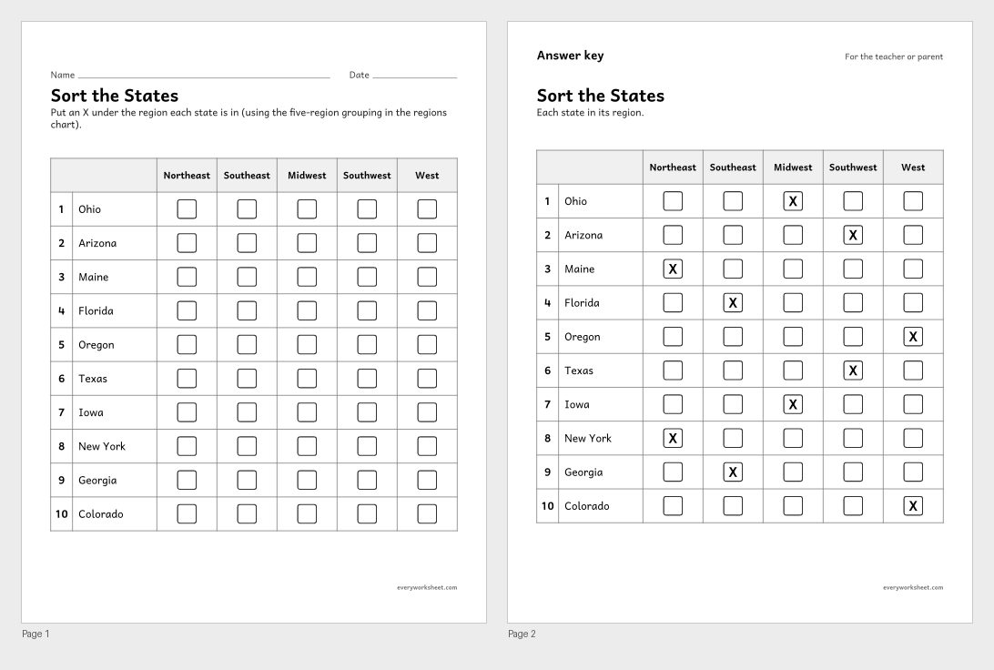
Sorting states into the five regions of the United States
Answer key on page 2
2 pages56 KB
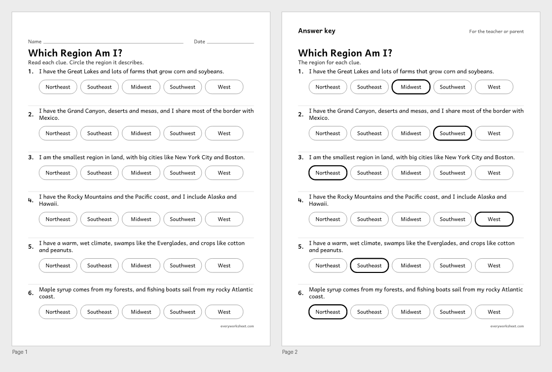 View all 2 pages
Identifying U.S. regions from clues about land, climate and resources
Answer key on page 2
2 pages39 KB
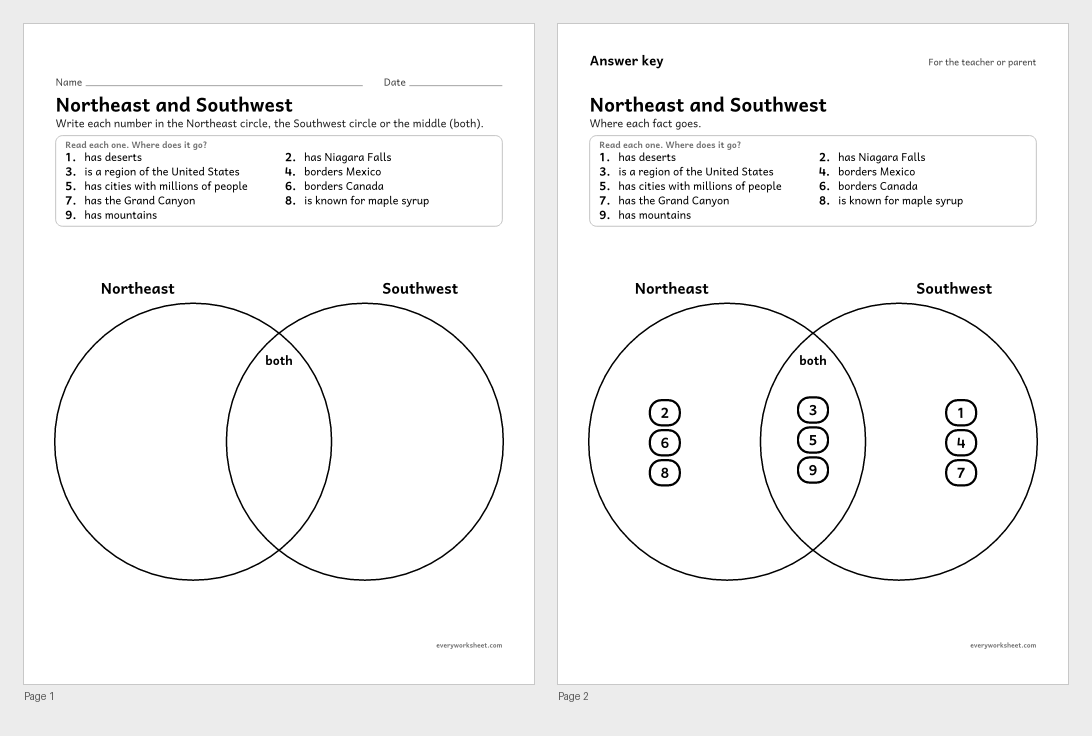 View all 2 pages
Comparing two U.S. regions on a Venn diagram
Answer key on page 2
2 pages42 KB
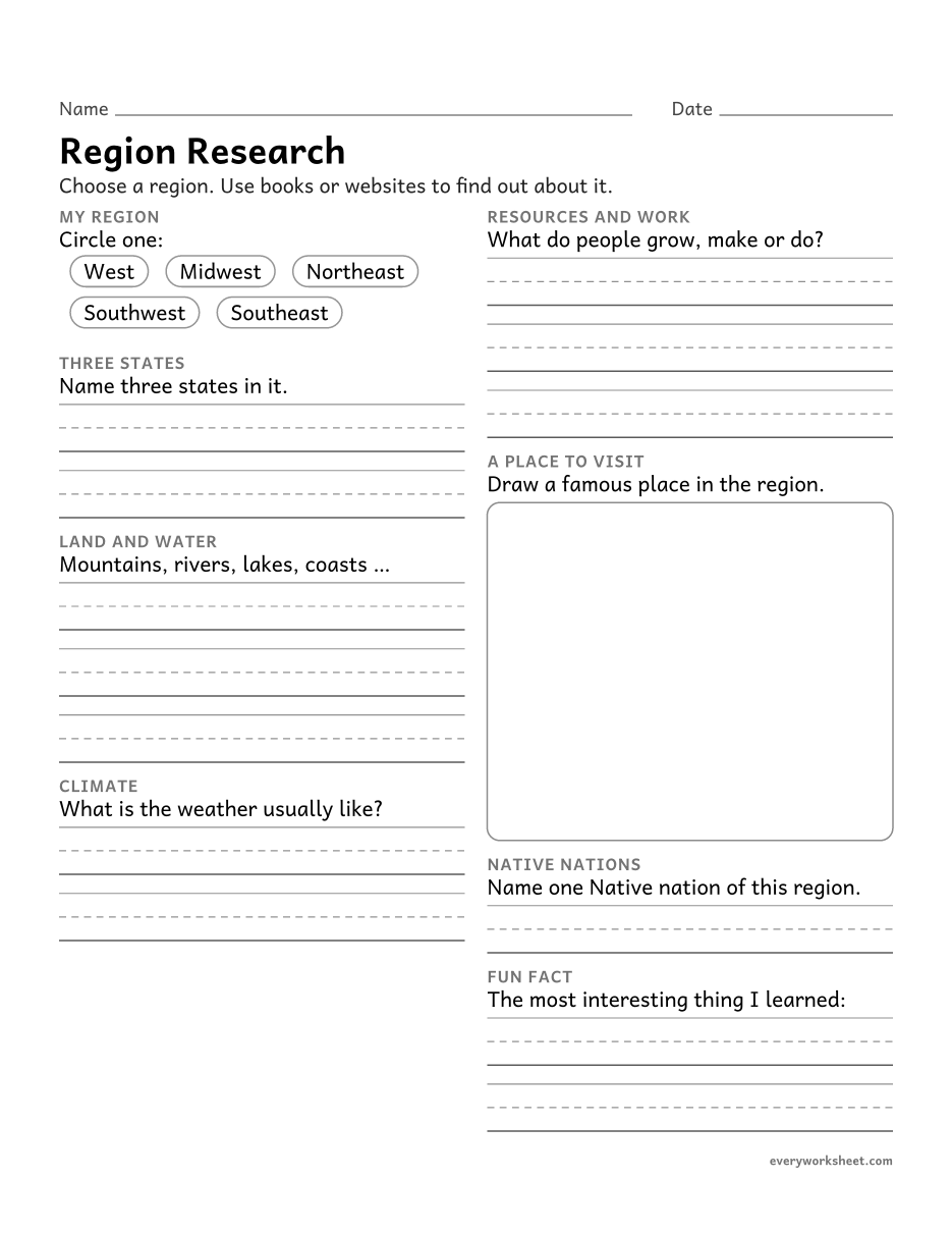 View larger
Researching and recording facts about a U.S. region
1 page29 KB
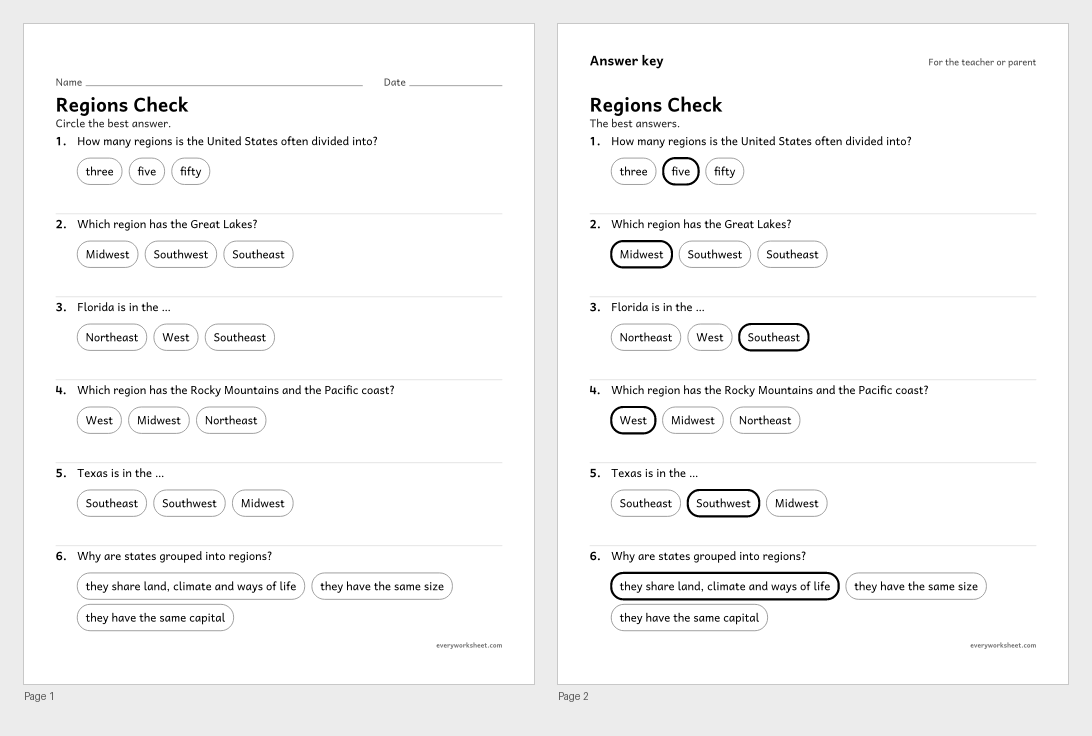 View all 2 pages
Reviewing the five regions of the United States
Answer key on page 2
2 pages39 KB
Print at 100% (actual size) for the cleanest tracing lines.
The United States is often divided into five regions: the West, the Midwest, the Northeast, the Southwest and the Southeast. States in a region share land, climate and ways of making a living.
These regions of the United States worksheets use charts and a simple box diagram rather than a detailed map. Children read a chart of each region's land, climate and resources, label the regions (with a cut and paste twin), use a chart of the states in each region, sort states, solve riddles, compare the Northeast and Southwest, and research a region of their choice.
Every page is black and white, prints on US Letter or A4, and every page with right answers has an answer key on page 2.
C3 D2.Geo.2.3-5Use maps, satellite images, photographs, and other representations to explain relationships between the locations of places and regions and their environmental characteristics.CCSS.ELA-LITERACY.W.4.7Conduct short research projects that build knowledge through investigation of different aspects of a topic.The West, the Midwest, the Northeast, the Southwest and the Southeast.
The states-in-each-region page lists all 50. The Southwest has the fewest (Arizona, New Mexico, Oklahoma and Texas); the Midwest and Southeast have 12 each.
These pages teach regions with charts and a simple diagram. Use a wall map or atlas alongside them.